

It’s time we once again return to one of my perennially favorite topics: the Geats of Beowulf and the conundrum of identifying the geographic location of their territory. Did the Geats hail from Götaland or Gotland or Jutland1 or a figment of the medieval imagination? No one really knows and no one ever will with absolute certainty, at least not until a time machine is built, which would probably be used to annihilate the entire human species before anyone with a benevolent disposition would find the chance to use it for something as awesome as interrogating the original Beowulf poet.
Anyway, a quick recap is justified here: in 2018 a prominent Swedish archaeologist by the name of Bo Gräslund released an academic study that challenged many long-held assumptions about Beowulf and the identity of the Geats. In this work, he posits that the Geats called the island of Gotland their home rather than the more commonly accepted mainland Scandinavian territory of Götaland. There’s much more to it than that (please read my earlier post, Beowulf the Gute?, if you’re interested in an overview of the other facets of Gräslund’s theory and how it caught on like wildfire in Sweden) but the relevant point here is that Gräslund also identified a site on Gotland that he believes was the primary meadhall of the Geats. So, we’re basically talking about the possible real-life home of Hygelac and Beowulf themselves (though only one of those figures seems likely to have actually existed).2
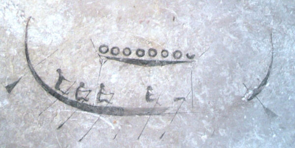
The site is known as Stavars hus (Stavar’s House) and is located in Burs near the coast on southeastern Gotland. The site is definitely real; the foundation of a very large hall dating to the correct time period has been found here. The site also includes the remnants of an ancient path that led to the hall, and the entire surrounding area is full of archaeological discoveries. In the middle of this entire historic complex is Stavgard Vikingagård, a modern reconstruction of a Viking Age village (which relates to a time period a bit later than that portrayed in Beowulf). Hans Wanneby is one of Stavgard Vikingagård’s directors and also co-author with Rikard Evertsson of a book that takes Gräslund’s theories and delves deeper into the local geography of Gotland itself: I Beowulfs spår (released with a slightly modified title in English as Home of Beowulf). In fact, they’re slated to be interviewed in English for the first time by Terri Barnes and C.J. Adrien over at the Vikingology Podcast in late March. More detailed information about that follows the photographic journey below.
And now that the basics have been covered, it’s time to get down to business: a simulated, image-heavy walking tour! I had the good fortune to visit Burs last spring on a gray, gray day when no one was around, which contributed to an overall atmosphere of foreboding that felt appropriate when considering the fate of the Geats so heavily alluded to at the end of Beowulf. But before we meander into the photographic walking tour, we should look at the maps shown below.


The first map illustrates the location of Beowulf’s House on Gotland in relation to Visby (the main city on Gotland), mainland Sweden, and Öland (Sweden’s second largest island after Gotland). The part of mainland Sweden shown on this map was not inhabited by the tribe commonly referred to as “Swedes” in Beowulf and that eventually gave their name to the present-day nation. The Swedes of Beowulf were instead concentrated around Uppsala and Lake Mälaren farther to the north. The Gutes of Gotland (and, admittedly, the Götar of Götaland, too) were situated between the ancestral homelands of the Swedes and the [Spear-]Danes. The second map zooms in on Burs and the location of Beowulf’s House. It also shows where some other sites of historic interest are located in relation to the house itself and the walking routes connecting them, all of which are touched upon below. So now, without further ado, scroll onwards to see the house and environs of Beowulf!3
As you approach the Beowulfs hus? sign from the north, the first thing you see is the palisade of Stavgard Vikingagård. The sign in this view is close to the palisade but hidden behind the shrubby plants lining the road to the right.

The iconic sign stands beside “Stavar’s Road.” The shorter sign has been installed by Länsstyrelsen Gotland (Gotland’s regional county government); a variety of these signs exist throughout the island at significant historical sites. This one explains how most of the relics in Burs are associated with a Viking Age chieftain known as Stavar the Great (or Big Stavar, if you prefer), although signs of inhabitation date back at least to the Migration Period. Stavar’s Road leads to the foundation of the massive meadhall identified as Beowulf’s possible house. In ancient times, Stavar’s Road was used for leading cattle out to pasture—the stones lining each side of the pathway kept the cattle in line.

The path winds its way through 1/4 mile of fields before entering a wooded area.


The path becomes narrower and a little less worn as you enter the wooded area, but there’s another sign to help prevent you from going astray.


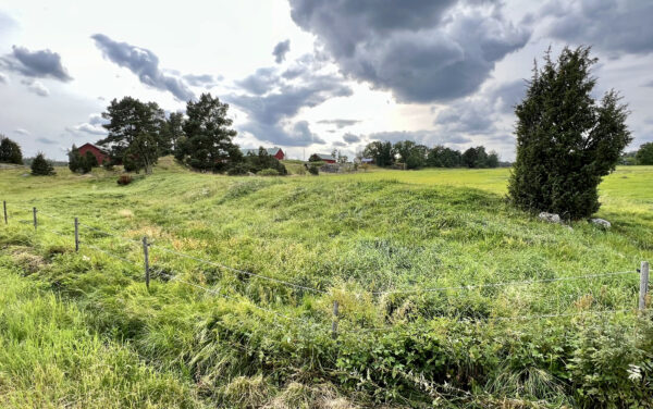
And then the woods begin to part as you come upon the foundation of Beowulf’s House.


The foundation of Beowulf’s House is substantial in size; a full 67 meters in length and the largest of the ~1800 hall foundations found on Gotland dated to the same epoch.


The sign posted beside the foundation explains that the site is only one of nearly fifty places scattered around Gotland that include “stav” in the name. These “stav”-places indicate a notion of enclosure and property ownership as well as a plausible connection to ancient pagan rituals. This prefix is also related to the “stave” more commonly seen in reference to Norwegian stave churches.
Stavars hus/Beowulf’s House was the third to be built in this same location, and the remnants of additional buildings from the same era are scattered around its vicinity.
After retracing your steps back to the Beowulf hus? sign, turn to the southwest and walk past the entrance to Stavgard Vikingagård to the far corner of its palisade wall. At this point, the footpath makes a 90 degree turn to the southeast and heads into thicker woods interspersed with fields. Electric fences are scattered around the area to prevent livestock from wandering into areas where they shouldn’t go and potentially damaging important archaeological artifacts.
The sign forbidding unleashed dogs in the area is courtesy of Burs Hembygdsförening (a local interest historical society), which is also responsible for Kulturstigen—the actual walking path and its associated informative signs this side of Stavgard Vikingagård. If you can read Swedish, you can learn more detailed information about the walking path and its associated sites here: Burs Hembygdsförening Kulturstig.4


After walking along the path a little less than 1/2 mile from the corner of Stavgard Vikingagård as pictured above, the first historic sites encountered are those pertaining to the Groovy Stones (Slipskåror) and Stavar’s Treasure (Stavars skatt).

The Groovy Stones are encountered first; they date to the Stone Age, and there are about twenty of them in the area, though the total number on Gotland gets into the thousands. It’s believed that the grooves were created by scraping the stones with a small stone, which sounds incredibly tedious but was probably a good use of time four thousand years ago. The grooves in the stones display apparent orientations to astronomical movements (specifically lunar), so that adds an extra element of enigma to the whole thing.

Past the Groovy Stones stands a stone in a field commemorating the spot where Stavar’s Treasure was discovered in 1975 by a class of school children. The treasure contained more than a thousand Arabic silver coins and an assortment of silver arm rings. Stories of the treasure had been preserved in local folklore for generations, and the short version is that Stavar buried it when some marauding Norwegians showed up. The Norwegians killed Stavar and his followers, burned the hall, and looked for the treasure but failed to find it. The apparition of Stavar continued to appear once each year to admire his loot before eventually getting sick and tired of that habit. He attempted to give his treasure to a drunken farmer who declined out of nervousness (he was dealing with a ghost, after all). Despite his own personal rejection of the free treasure, the farmer nonetheless managed to finagle a deal whereby his descendants would inherit the treasure several generations later instead. Stavar’s apparition thought that sounded like a good idea and then disappeared mysteriously.
Returning to the main path and continuing along it for another 1000 feet brings you to Åmynningen, which would have been the mouth of a river in the Viking Age and earlier. It’s a very scenic and atmospheric spot.


Turning back to the main path and heading north leads to the remnants of the Boathouse (Snäckhuset). Boats were dragged out of the water and up to the Boathouse; iron nails were found here of a type used in Viking Age ships. Near the Boathouse is the Sacrificial Stone (Offerstenen), though that seems to be more of a darkly amusing nickname than an actual indication of any former blood ritual use it may have experienced.


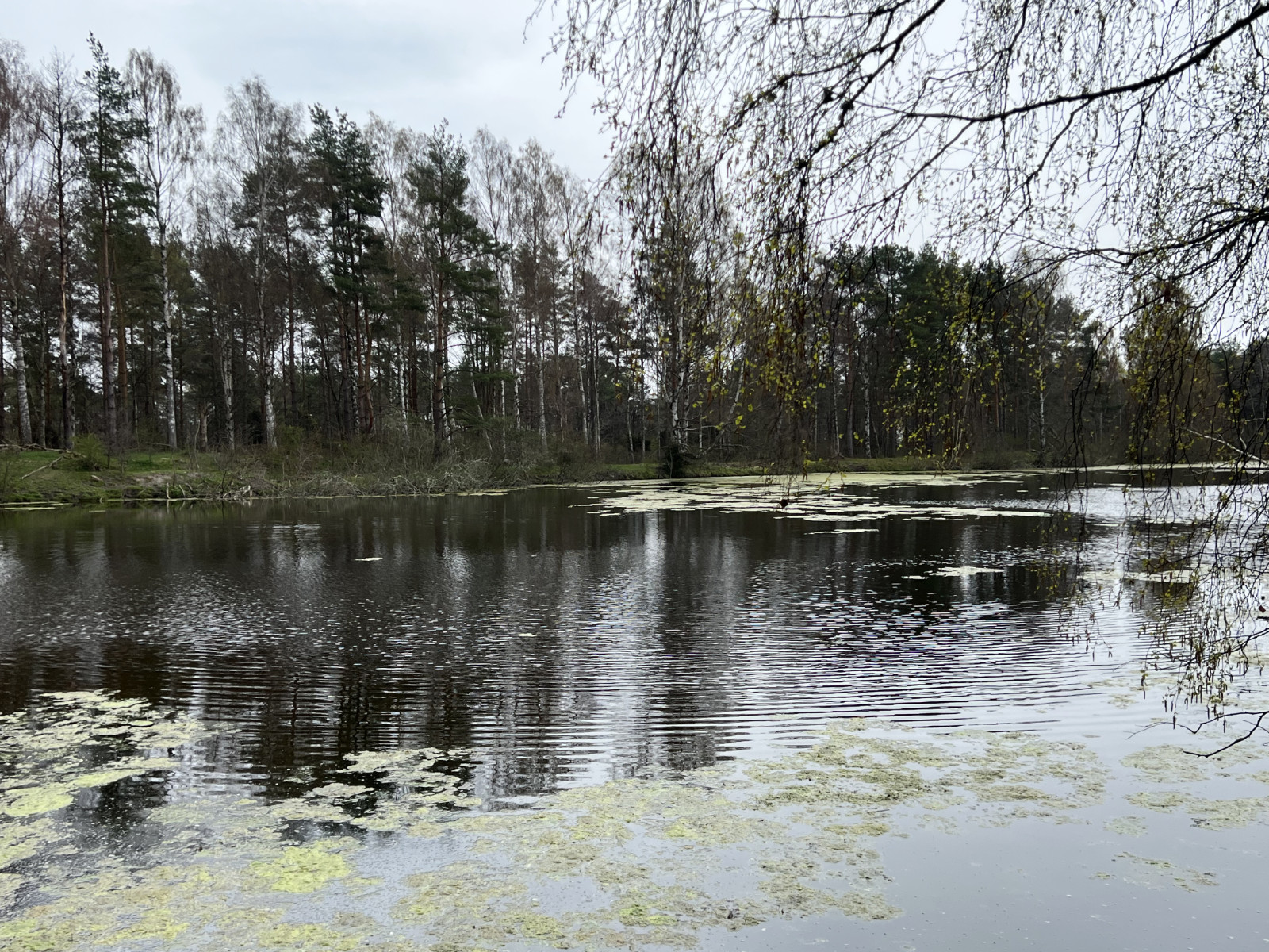
Continuing in the same direction and not far from the Boathouse and the Sacrificial Stone is the Viking Age Harbor (Den vikingatida hamnen), which is a dammed pond today undergoing a notable degree of algal blooming.

The last stop of this photographic journey is Stavar’s Waterhole (Stavars brye). As its name suggest, it’s a small depression in the landscape filled with water and associated with the mighty Stavar, though it consisted primarily of damp ground when I visited it. The woods surrounding it include a high proportion of ash trees, so the likelihood is that this waterhole was used for sacrificial purposes in pre-Christian times.

There are many other sites of historic and archaeological interest dating to the Viking Age and earlier on Gotland. Cairns and earthen burial mounds are within short walking distance of the sites shown here. Other sites with surprisingly fitting correlations to places specifically described in Beowulf also exist, such as the seawall mentioned in the poem and the location of the hero’s funeral pyre itself.

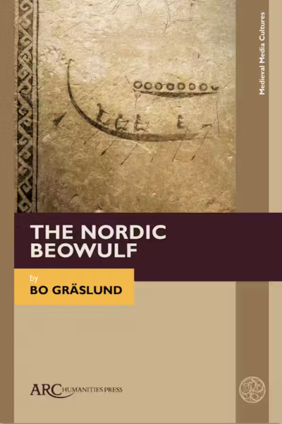
As mentioned at the top of this post, Bo Gräslund breathed new life into the whole theory that Beowulf‘s Geats were actually the Gutes of Gotland (he was not the first to suggestion the notion). Anyone interested in diving deeper into the theoretical and archaeological underpinnings of these notions would do well to read his book, Beowulfkvädet: Den nordiska bakgrunden (translated into English as The Nordic Beowulf). The Swedish version is no longer in print but can be downloaded for free from Kungl. Gustav Adolfs Akademien för svensk folkkultur while the English version is available from ARC Humanities Press.


Additionally, readers interested in real-life, modern-day places on Gotland and how they correlate to the places and events described in Beowulf should check out I Beowulfs spår (released with a slightly modified title in English as Home of Beowulf) by Hans Wanneby and Rikard Evertsson, which is available as a physical book and ebook in Swedish at BoD and as an ebook in English at Amazon. And as mentioned at the top of this post, the two authors will be appearing on the Vikingology podcast in late March to discuss their work connecting Beowulf to Gotland with Terri and C.J., so that shouldn’t be missed. The interview will be conducted in English, making it a rare chance for non-Swedish speakers to learn about the theory, history, material remains, and places of interest on Gotland pertaining to Beowulf directly from people who actually live there and have investigated the relevant sites firsthand.

And if anyone ever has the chance and wishes to explore the area with a knowledgeable, local guide, Octavia Randolph, author of The Circle of Ceridwen Saga of Viking Age historic fiction novels, offers guided tours to some of Gotland’s most impressive historic sites, including Burs. The tours run on a bi-yearly basis with the next ones offered in August of 2027 to coincide with Visby’s renowned Medieval Week. More information about them may be found here: The Saga Tours.
Finally, if you’re curious and content to just poke around looking at additional imagery of archaic Swedish places relating to Gotland and the general concept of Geatishness, please check out these prior posts that deal with the mythological progenitor of the Gutes on Gotland and the defensive, earthen fortifications of the eastern Götar.

Footnotes
- Okay, the Jutland one has pretty much been thoroughly discredited. ↩︎
- Though Gräslund suggest that Avair Stråben from Gutasagan was a real-life basis for the character of Beowulf. ↩︎
- This statement is obviously only true if Gräslund’s theory is correct, which can’t actually be proven one way or the other, but it’s still awesome to think about. ↩︎
- Kulturstigen offers a specific sequence of stops along its route. I most definitely deviated from that sequence. ↩︎
All photographs and maps shown on this page are © Rowdy Geirsson unless noted otherwise. All logos and bookcovers shown on this page are © of their respective owners.
Subscribe to get updates from Scandinavian Aggression!
You know, if you feel like it or whatever. Your email is only used to send updates when new nonsense has been posted to the site. It's stored in the secure abyss of WordPress and not shared anywhere or anyhow else. Skål som fan!